Drive the original Route 128
As you look at this map of Eastern
Massachusetts
in 1895, note how most of the railroads radiated in and
out of
Boston. Over subsequent decades, roads built for the
growing automobile population generally
followed this pattern, as well. Consequently, by the
1920s, as thousands
of commuters and vactioners travelled between the north
and south shores,
Boston was in constant gridlock. The DPW's response
was
to designate dozens of existing roads, streets, and
avenues about 15 miles from Boston as a
circumfrential route around the city. They designated this
collection of roads as Route 128. This page
is a partial recreation of what a drive from Cape Ann on
the north shore
to Hull on the south shore would have been like on the
old, "ad-hoc" Route
128. The complete series can be found in Building
Route 128
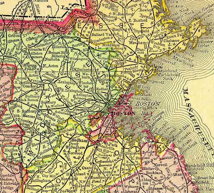
Looking north up Cabot Street in Beverly,
from the intersection
with School Street,
which was one of the pieces of the "ad-hoc"
Route 128
as designated by the DPW.
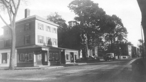
Lynnfield's part of Route 128 history can be
traced back
to the days of the "ad hoc" 128, when Salem Street (shown
above) carried
traffic around Boston before the divided highway was built
between 1938
and 1959.
Lexington Street (part of the old Route
128) crossed Cambridge
Street
in the Four Corners section of Woburn.
That's O'Rourke's
Mobil
Station, which is still in business today in
the same
lcoation.
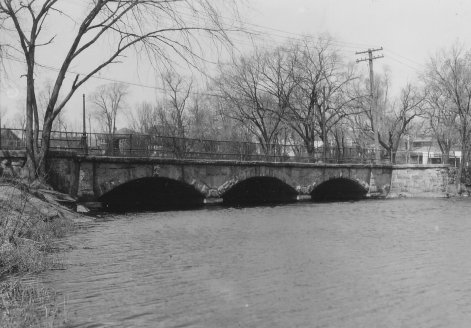
This nineteenth century stone arch bridge
carried the
old Route 128
(Newton Street) over the Charles River in
downtown Waltham.
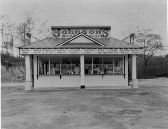
At the corner of Route 28 and the old "ad
hoc" 128 was
one of the first
franchised Howard Johnson's (and, according
to the Randolph
Historical
Commission, it was owned by founder's
brother-in-law).
Old Route 128
(also known as Blue Hill River Road) is on
the right.
On this site today is
a Holiday Inn and Lantana's.
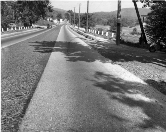
Looking up Route 28 in Randolph from the
corner of Russ
Street in the 1930s.
Chickataubut Hill is on the right in the
distance, and
Buck Hill is straight ahead.
The old, "ad hoc" Route 128 cut across this
picture about
a quarter of a mile
ahead, right where the Blue River crossed
Route 28.